



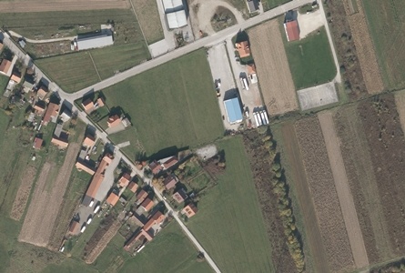
The fastest and easiest way to collect information of certain area at a specific time is based on the aerial or satellite survey. Interpretation of these sources for different purposes is made by standard and automated photogrammetric methods on digital photogrammetric stations. 3D topographic data are recorded using stereoscopic principles and are used for construction designing, production of databases and topographic maps of various scales and for various spatial analysis and visualizations.
Aerial survey is performed with precise digital photogrammetric cameras and LIDAR systems. The size of the image element depends on the purpose of information and ranges from 5 to 50 cm while LIDAR point density can vary for 1 pt/m2 up to 20 pts/m2 or more. The acquisition of satellite images and aerial survey are done in cooperation with certified partners and authorized state administration bodies..
Within the photogrammetric department of Geoprojekt, the following processes are supported:
PRODUCTS AND SERVICES:
REFERENCES:
Production of digital orthophoto maps 1:5000 from satellite images for the border area of the Republic of Croatia and the Republic of Slovenia, Agency for agricultural payments, fisheries and rural development, 2016
Production of digital orthophoto maps 1: 5000 for the eastern and southern parts of the Republic of Croatia, Državna geodetska uprava, 2015
Production of digital orthophoto 1: 5000 from aerial photogrammetric images surveyed before 1968 for the Republic of Croatia, Državna geodetska uprava, 2014
Georeferencing photogrammetric images survey before 1968, Državna geodetska uprava, 2013